


Residential/Commercial Sinkhole Studies
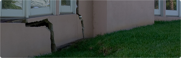
The investigation of potential karst (sinkhole) activity at residential or commercial properties or undeveloped land is a multi-disciplinary process in which geophysics plays a critical role. Subsurface geology in karst environments is very complex and is often masked at the surface. Properly selected and applied geophysical tools will provide a 2 or 3 dimensional perspective of subsurface geological conditions in these settings.
 The changes in subsurface conditions connected with karst activity are typically associated with variations in soil density, disruptions or discontinuities in lithological layers, voids or highly-irregular top of rock profiles. Such subsurface changes can usually be characterized by electrical (GPR and ERI), seismic (MASW, reflection or refraction) or gravity methods.
An understanding of karst geology is critical in being able to properly design and interpret the results from geophysical studies. GeoView is a Florida-based firm with four Florida Professional Geologists on staff. Almost all our professional staff have been educated and trained in Florida. This background and knowledge provides an in-depth understanding of karst-related geology and the process of sinkhole formation. GeoView has conducted over 10,000 sinkhole-related investigations. The majority of these investigations were conducted in Florida, but studies have also been performed in Kentucky, Tennessee, Georgia, Alabama and Pennsylvania. The other strength which makes GeoView unique is that GeoView owns and regularly operates all the necessary geophysical equipment to conduct any type of karst study. Accordingly, the appropriate technology for your geological setting will be utilized.
Sinkhole studies are typically conducted as either: 1) A component of geotechnical or structural evaluation studies designed to determine the cause of damage for residential or commercial structures or 2) A site assessment to determine the location and potential for sinkhole-related activity prior to construction or development at a site. Geophysical studies do not replace the need for follow-up geotechnical or geological investigations, but rather to provide information that helps to guide subsequent drilling programs or to increase the understanding of subsurface site conditions. Recommended direct testing locations, based on the geophysical results, are typically provided as part of any investigation.
Ge oView offers an array of methods to evaluate karst conditions. These methods include:
-
Ground Penetrating Radar is the most flexible, accurate and cost effective of the geophysical methods. The exploration depth of the method is controlled by the electrical conductance of the near-surface earth materials and selected frequency antenna. Sinkhole related investigations are typically conducted with either a 250 or 100 MHz antenna.
 Electrical Resistivity Imaging (ERI) provides a vertical two-dimensional profile of earth material resistivity. Exploration depths are controlled by the maximum transect length allowed by site conditions and the presence of interference sources. GeoView can conduct ERI surveys using either a 56 or 112 channel system with electrode spacings of up to 20 ft.

-
Seismic studies provide a vertical two-dimensional
 profile of either Compression (P) or Shear (S) wave velocities. GeoView can conduct MASW, Reflection, Refraction or REMI using either a 24 or 48 channel seismograph. Cross-Hole or Downhole studies can also be performed.
 -
Gravity surveys are usually performed for large scale regional investigations and are typically combined with other methods
- Floor Elevation Studies are performed to identify the amount and direction of slope of the structure's floor


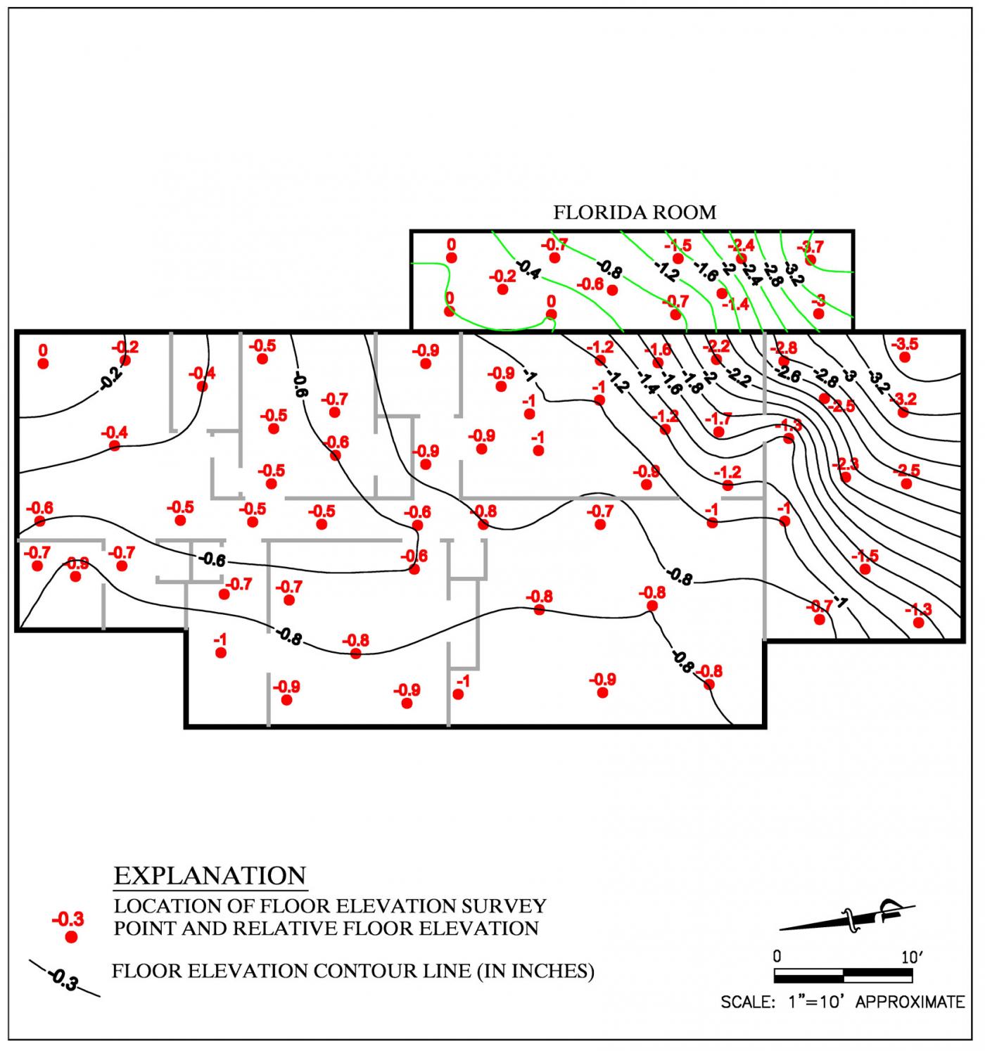
Contour Map of Floor Elevation Study
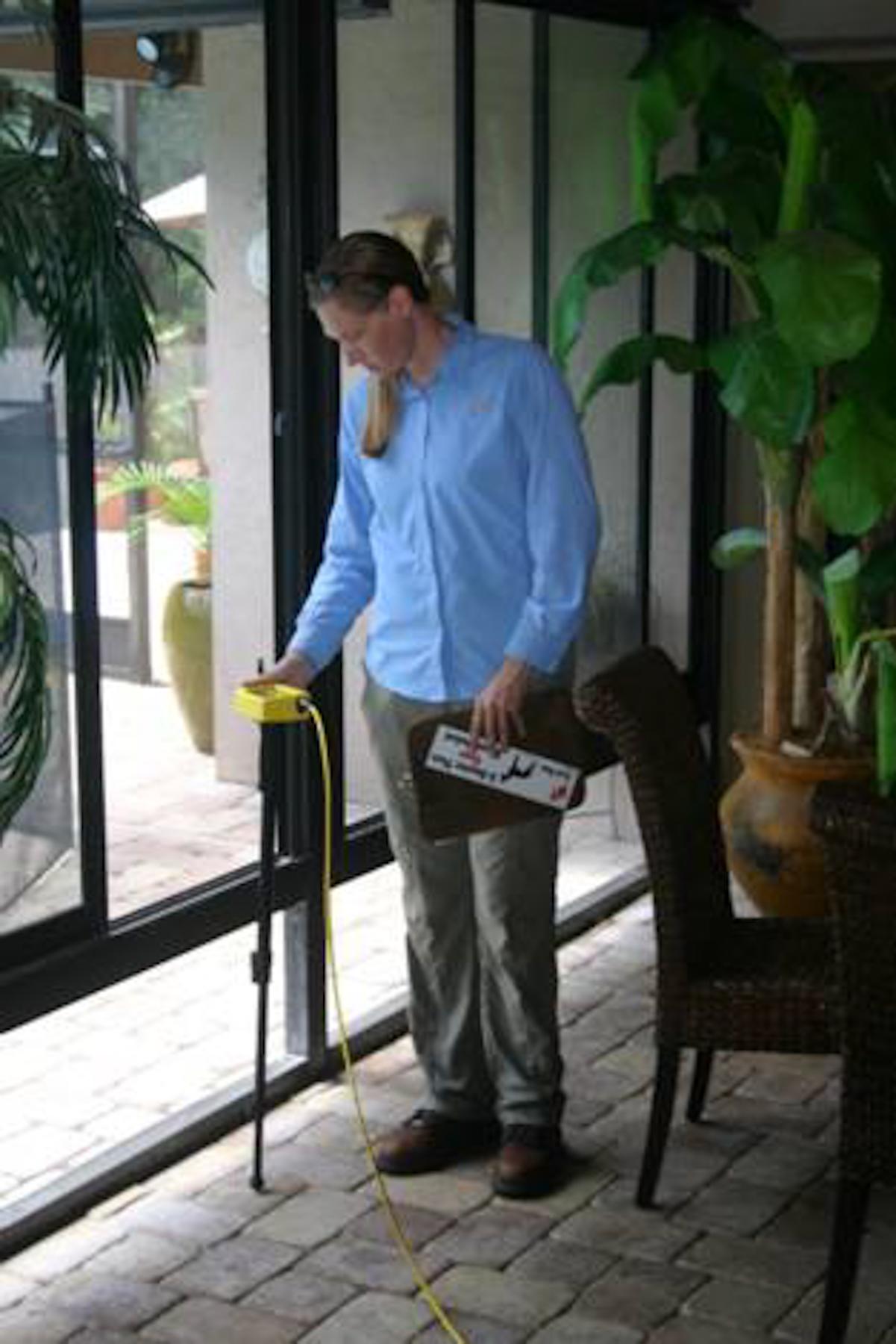
Collection of Floor Elevation Data
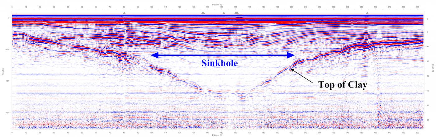
Example of GPR data