Side scan sonar is used to create images of the seafloor. An acoustic beam is transmitted to either side of the side scan sonar survey track. As the acoustic beam travels outward from the side scan sonar, the seabed and other obstructions reflect portions of the sound energy back in the direction of the side scan sonar. The travel time and amplitude of these reflections are analyzed to create the seafloor images. During post processing, the targets lateral dimensions, height and geographic coordinates can be calculated.
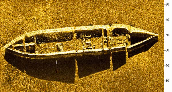
Side scan sonar can be used for archaeology research, salvage, search and recovery, utility mapping, reef evaluations, sea grass bed mapping, grain size surveys, channel or port surveys, and dredging research. The high resolution images are capable of imaging objects as small as several inches in size.