Key Personnel

Key Personnel
Michael J. Wightman, P.G., President
 Mr. Wightman’s current responsibilities include management and technical oversight of all geophysical investigations conducted by GeoView Inc. He has managed and conducted geophysical investigations throughout the United States and the Caribbean Region. His responsibilities have included project management and budgeting, employee supervision and training, design and implementation of geophysical investigations, data evaluation, numerical and analytical modeling of geophysical data, and coordination and supervision of fieldwork. He has conducted and managed several thousand geophysical investigations to identify potential and actual sinkhole features. He has also performed hundreds contamination assessment investigations throughout Florida where his responsibilities included project management, geophysical investigations, design of groundwater monitoring systems, data evaluation, groundwater modeling, and report preparation.
While working on his M.S. degree in hydrogeology at the University of South Florida, he was involved as a principal investigator on several coastal and island aquifer research projects. In these projects, he used electromagnetics and direct current resistivity to map salt-water interfaces and developed considerable shipboard experience involving sediment analysis, vibracoring, refraction seismology, and mission planning. Results from his research have been presented at two international conferences, three Florida statewide conferences, and have appeared in several publications.
Christopher Taylor, P.G., Vice President
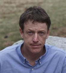 Mr. Taylor is responsible for senior-level project management and review at GeoView where his duties include complex, multiple-method geophysical investigations, employee management/review, and the lead for new technology and methods development. Mr. Taylor has over 18 years of experience in managing geophysical investigations throughout the United States, Panama and the Caribbean Basin. He is a licensed Professional Geologist in Pennsylvania and Florida. His duties have included project management, budgeting, designing, and implementing geophysical investigations, data evaluation, numerical and analytical modeling of geophysical data, and coordination and supervision of fieldwork. Mr. Taylor is proficient with subsurface and borehole geophysical technologies and applications that include seismic refraction/reflection, seismic down-hole/cross-hole, ground-penetrating radar, electromagnetics, magnetics, resistivity, marine and utility locating surveys.
Stephen R. Scruggs, P.G.
As senior geophysicist for GeoView, Mr. Scruggs is responsible for performance and management of high-level, multi-method geophysical investigations. His primary duties include field project management, data analysis, report preparation, and personnel supervision and training. He is also the Office Manager for the GeoView office in Jacksonville, Florida. He has conducted geophysical investigations throughout the United States and the Caribbean Region and has served as Project Manager for national and international geophysical investigations. Mr. Scruggs is proficient with sinkhole investigations, utility and underground storage tanks locating, geological boundaries mapping, buried debris delineation and structural investigations (e.g., bridge deck, rebar evaluations, cellular tower foundation surveys).
Robert Roth
Mr. Roth is the manager of GeoView’s Utility Designation Department. He has over 12 years of experience in managing and conducting utility designation projects. His primary responsibilities include managing and conducting subsurface utility engineering (SUE) Level B through D studies, rebar and post tensioning locates and void studies. In addition, Mr. Roth coordinates the training of utility designating personnel and the implementation of new utility locating techniques.
Craig Fusaro, REM
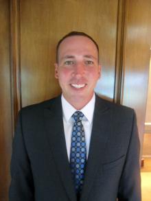 Mr. Fusaro the manager of GeoView’s Boca Raton Office. He has over 16 years of experience in managing and conducting geophysical and environmental projects in Florida. Mr. Fusaro is a Registered Environmental Manger and is able to use that knowledge when designing geophysical investigations. He is a certified Ground Penetrating Radar Operator and is proficient in the use of electromagnetic, magnetics, resistivity, conventional EM utility location and GPS equipment.
Sean Malphurs
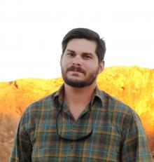 Mr. Malphurs is a geophysicist and GIS professional based out of the Jacksonville Office. He joined GeoView after serving as a Topographic Sargent in the U.S. Army, Corps of Engineers from 2002 to 2006. He has over 11 years of experience managing and conducting geophysical investigations throughout United States, Caribbean, Central and South America. Mr. Malphurs is proficient with geophysical technologies and applications that include ground-penetrating-radar, electromagnetics, magnetics, resistivity, acoustics (Pile Integrity Testing, Olsen - Impact Echo), karst characterization, foundation mapping, rebar/post tensioning location, void delineation, buried debris/UST location, and utility location. He has a depth of experience in mapping, GPS technologies, and Geographic Information System (GIS) projects, raster/vector processing and analysis, and is well versed in software applications that include ESRI, Autodesk, and Surfer.
Scott Purcell
Mr. Purcell left the United States Navy in 1993 and received his Bachelor of Science in 1999. He spent the early portion of his career with Subsurface Evaluations under the tutelage of Bill Wilson. Mr. Purcell joined GeoView in 2012 and is now responsible for senior-level project management and data review. Mr. Purcell has certifications for ground-penetrating-radar, resistivity, capacitively-coupled resistivity, seismic refraction, MASW and electronic utility locating. Mr. Purcell is proficient with a range of geophysical technologies and applications that include seismic MASW, ground-penetrating radar, electromagnetics, magnetics, resistivity, marine and utility locating surveys.

