


Sediment Thickness Study of a Coal Ash Pond
West Virginia
Recent updates to how the EPA regulates coal ash have made it necessary for power plants to study the designs of their existing ash ponds and determine the thickness of the ash sediments within the ponds. GeoView's portable sub-bottom profiling system has proven to be extremely effective for this purpose.
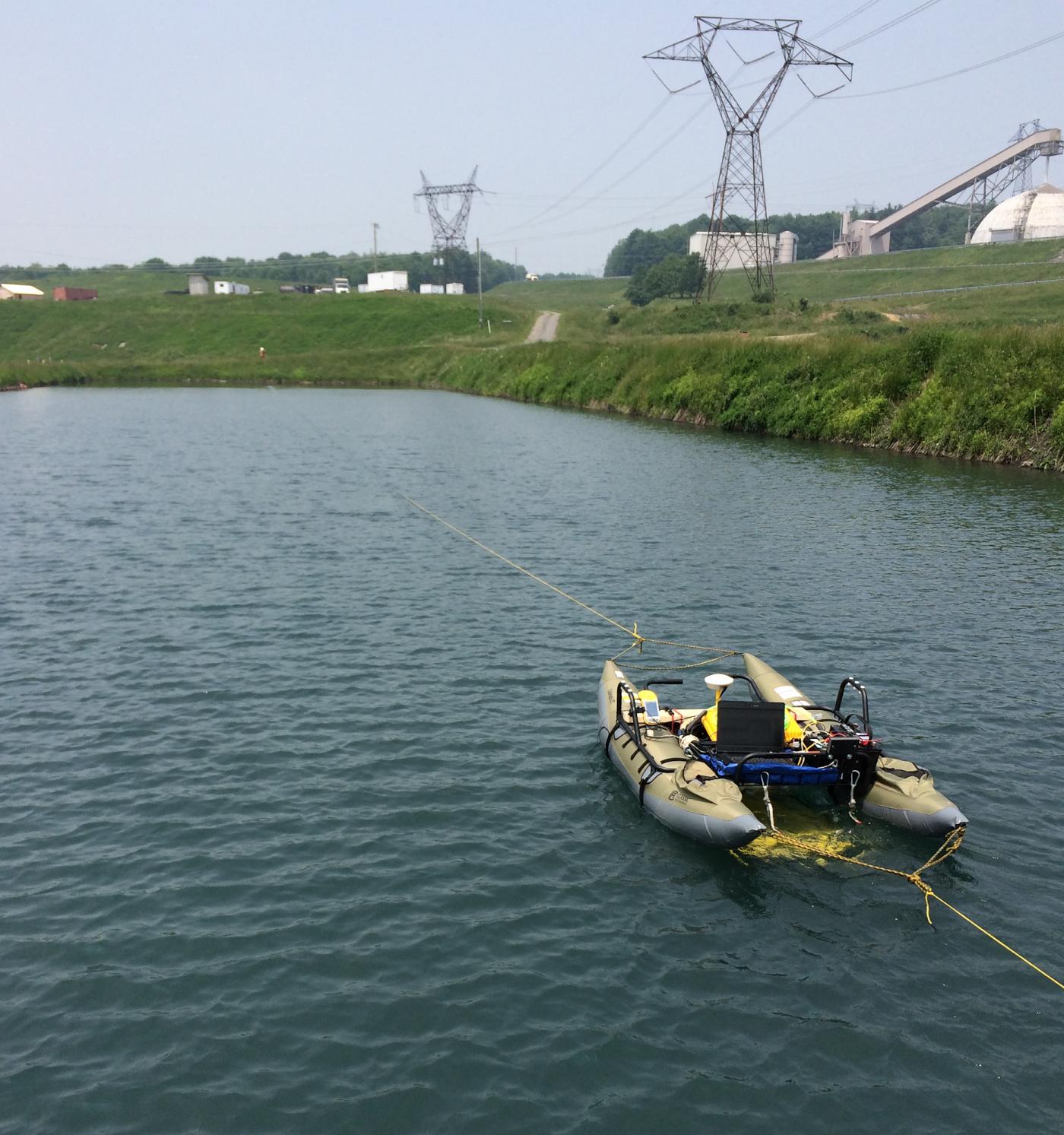
GeoView was tasked with mapping the top and bottom of the ash sediment within four ash settling ponds at a power plant in West Virginia. Due to site specific safety regulations, the data had to be collected using an unmanned boat. The sub-bottom data was collected using an Edgetech 3100 topside system with a 216 tow fish. The towfish was mounted to the underside of a portable pontoon boat. The vessel was pulled across the ponds by hand from the shore using ropes. Data was communicated wirelessly from the vessel to a computer on shore, which allowed for real-time monitoring of the data. The survey was conducted along parallel transects spaced approximately 20 feet apart within each pond. The positions of the geophysical transect lines were recorded using a differential Trimble Global Positioning System (GPS).

The data was processed using Edgetech Discover software. The two way travel time distances to the top and bottom of the ash were digitized and the depths (elevations) were calculated using a velocity of 4,870 feet per second. The survey was able to provide accurate sub-bottom information for both the top of the ash and the bottom of the ash/pond bottom interface. Contour maps showing the elevation of the ash sediment were produced.
(Click on Images Below to Enlarge)

