


Determining the Design of Buried Foundations
 Foundation Mapping
Determining the three-dimensional design of foundations for telecommunications towers, buildings and road signs can be impractical and sometimes nearly impossible using conventional means. Properly applied geophysical test methods, hand probing and shallow test pits provide a very cost-effective and non-destructive approach to determining the design of foundations. GeoView has conducted literally 1,000’s of investigations evaluating buried foundations for telecommunication towers across the United States. Monopoles, self-support and guy-wire anchor foundation systems have been studied in both urban and remote rural settings. Many building and bill-board sign foundations have also been tested.
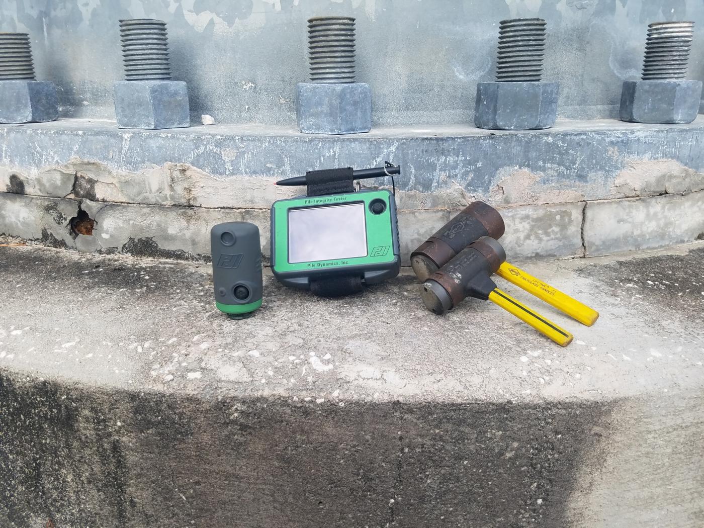
The plan view geometry of buried foundation elements is determined using Ground Penetrating Radar (GPR), hand probing and shallow test pits. The third (vertical) dimension is determined using either a Pile Integrity Tester (PIT) or GPR. For special cases when estimated lengths of drilled shafts need to be confirmed, more intrusive testing can be done. This typically involves the installation of a cased test hole next to the foundation and the performance of either a downhole seismic or downhole magnetometer survey. While on site GeoView also documents general site conditions, provide measurements of above-ground foundation elements and provides photo-documentation of the results. Configuration of rebar reinforcement in the exposed portions of the foundations can also be provided.


Site Plan Showing Foundation Design