Sinkhole Investigation
Proposed Landfill Site - Sumter County, Florida
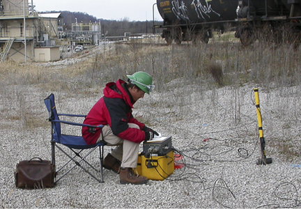
 A geophysical site characterization study was performed by GeoView to assist in the placement of a planned Class 2 Landfill in Florida. The survey area was approximately 160 acres. GeoView performed a ground penetrating radar (GPR) study map the lateral boundaries and determine apparent severity of karst (sinkhole) features. Electrical resistivity imaging (ERI) was later used to provide a vertical characterization of the GPR-identified features.
The GPR data was collected using a Mala GPR system with a 250 MHz antenna. Penetration depth of the GPR signal ranged from 10 to 30 ft (3 to 10 m). The GPR survey was conducted along an approximate grid pattern of transects spaced 50 ft (15 m) apart. The GPR instrumentation was towed behnd an all-terrain vehicle and position control was maintained by using an integrated differentially corrected GPS system. By using this approach the need to set up a survey grid across the site was avoided, greatly enhancing project efficiency, accuracy and cost effectiveness. Over 50 anomaly areas were identified, comprising approximately 10 percent of the overall project site.
 Anomalies were ranked in terms of apparent severity in order to help direct the placement of the ERI transects and geotechnical testing activities. 10,000 linear feet of ERI data was collected across the site. The position of the ERI transects was directed by the location and apparent severity of the GPR anomalies. The ERI data was collected with a 112-channel AGI SuperSting R8 resistivity system. Subsequent test borings showed excellent correlation between the geophysical anomalies and karst conditions.
Data Samples Collected from the Project Site - Click to Enlarge
ERI Data Sample Showing One of the Suspected Karst Features
GPR Data Sample Showing One of the Suspected Karst Features


