Unexploded Ordinance Study
Jacksonville, Florida / TDEM
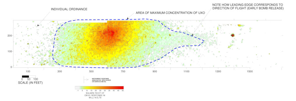
A geophysical investigation was conducted at a World War II era bombing range in the northeast Florida. The site was approximately 2,000 feet by 300 feet in plan dimension. Historical information indicated that MK23 practice bombs, 2.75” rockets, and 100 pound practice bombs may have been used near the site. The purpose of the geophysical investigation was to determine the presence and location of the ordinance buried at the project site. At the time of the investigation, the site was a slightly wooded field with only minimal evidence of the former use of the site.
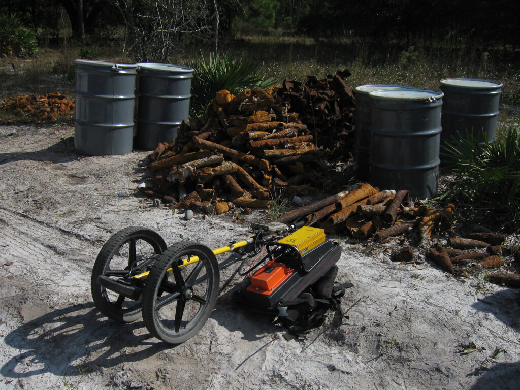
The geophysical investigation was conducted using time domain electromagnetics (TDEM). Initially, the investigation was conducted using a Geonics EM-61MK2 with a .5 meter coil. Geophysical measurements were conducted along transects spaced 2.5 feet apart, with readings collected every .6 feet along each transect line. A total of 275,000 readings were collected. The data was then contoured and a list of potential targets was generated. A Geonics EM-61 MK2hh was used to accurately locate the targets of interest.
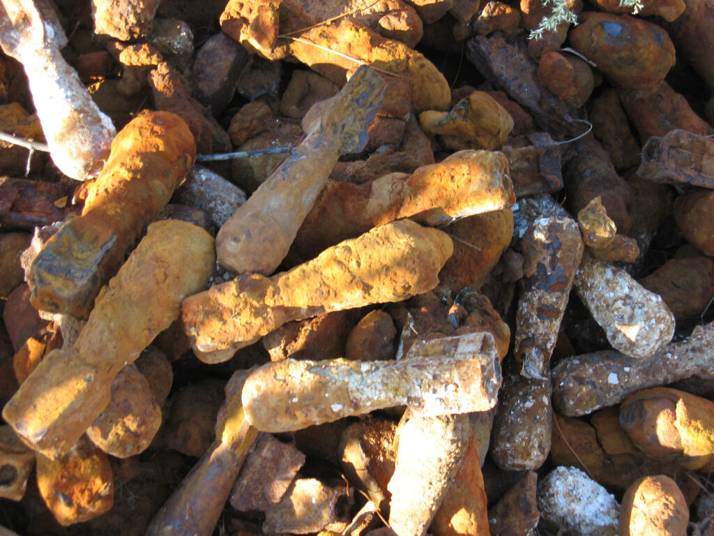
The apparent center of the bombing range was clearly identified as a “bulls-eye” on the contour map of the geophysical data. A seven foot by seven foot test pit performed within the suspected center of the bulls-eye identified over 100 pieces of ordinance within the test pit. Within areas of lower concentration of ordinance, outside of the bulls-eye, the location of each individual ordinance was identified and marked with a survey flag. Upon completion of the removal of the identified ordinance, a second geophysical investigation was conducted to verify that all of the ordinance had been removed from the project site.