Mapping Landfill Boundaries
Broward County, Florida / 2010 / EM, GPR
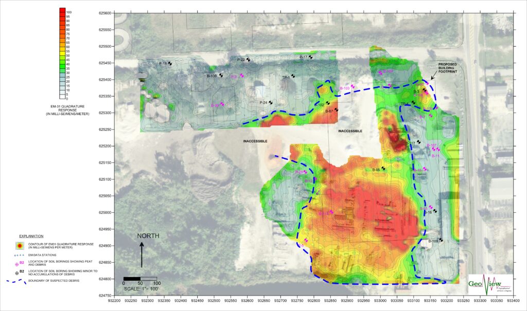
GeoView was tasked with performing a geophysical investigation at a construction site in Broward County, Florida. The purpose of the investigation was to locate the boundaries of a reported former unregulated landfill. The landfill was reported to be within the location of a former limestone quarry. Historical records indicated that the landfill contained both metallic and landscaping debris. Portions of the survey area were inaccessible due to construction activity. GeoView used a combination of frequency domain electromagnetics and ground penetrating radar for the study.
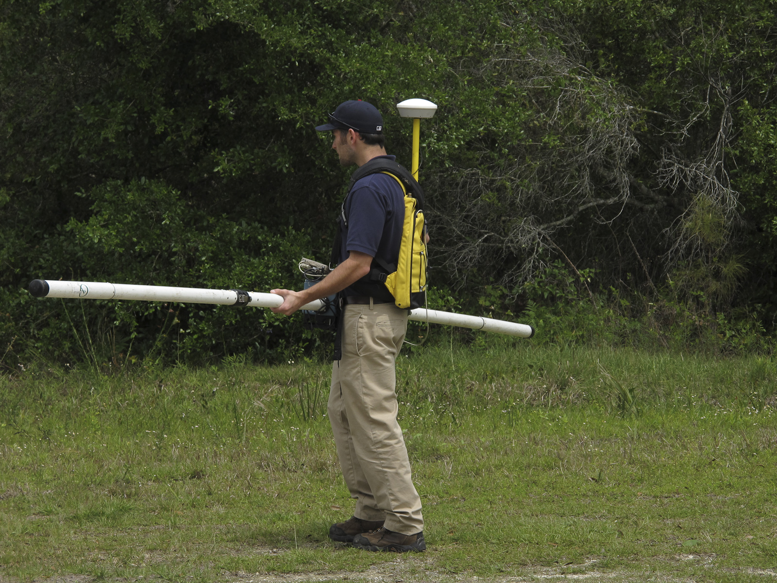
The frequency domain electromagnetic (EM) portion of the geophysical investigation was conducted using a Geonics EM31-MK2 in a vertical dipole orientation. This orientation provided bulk conductivity and inphase data for soils to an approximate depth of 15 to 17 ft bls. There are two components of the induced magnetic field measured by the EM31 equipment. The first is the quadrature-phase (out-of-phase) component that measures the bulk conductivity of soil and groundwater. This is referred to as the terrain conductivity response with units that are expressed in milli-siemens per meter (mS/m). The second component is the in-phase response that is relatively more sensitive to large metallic objects such as pipes, drums, large items of buried metallic debris and underground storage tanks. This portion of the instrument response is expressed in parts per thousand (ppt). In areas where no metals are present the in-phase response is zero. By using the in-phase and quadrature-phase components, it was possible to determine whether a change in bulk conductivity was due to the presence of buried metallic objects or due to changes in either subsurface soil conditions or pore fluid conductivity.
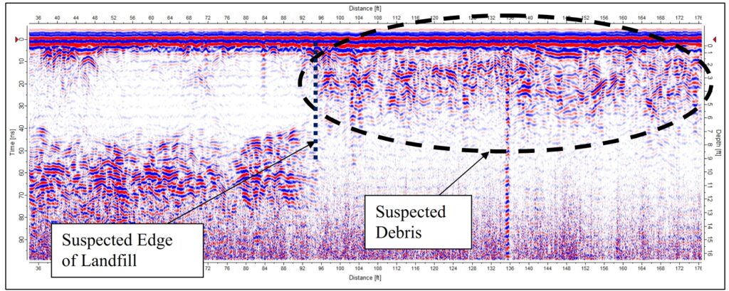
The GPR data was collected using a Mala radar system with 250-megahertz antenna. The GPR provided information to an estimated depth of 10 to 15 ft below land surface.
The geophysical survey successfully identified the lateral boundaries of the suspected landfill. The boundaries were evident on both the EM and GPR data. In addition, by analyzing both the inphase and quadrature responses, it was possible to determine the areas of highest metal content within the landfill.