Borehole Logging

Corozal, Puerto Rico

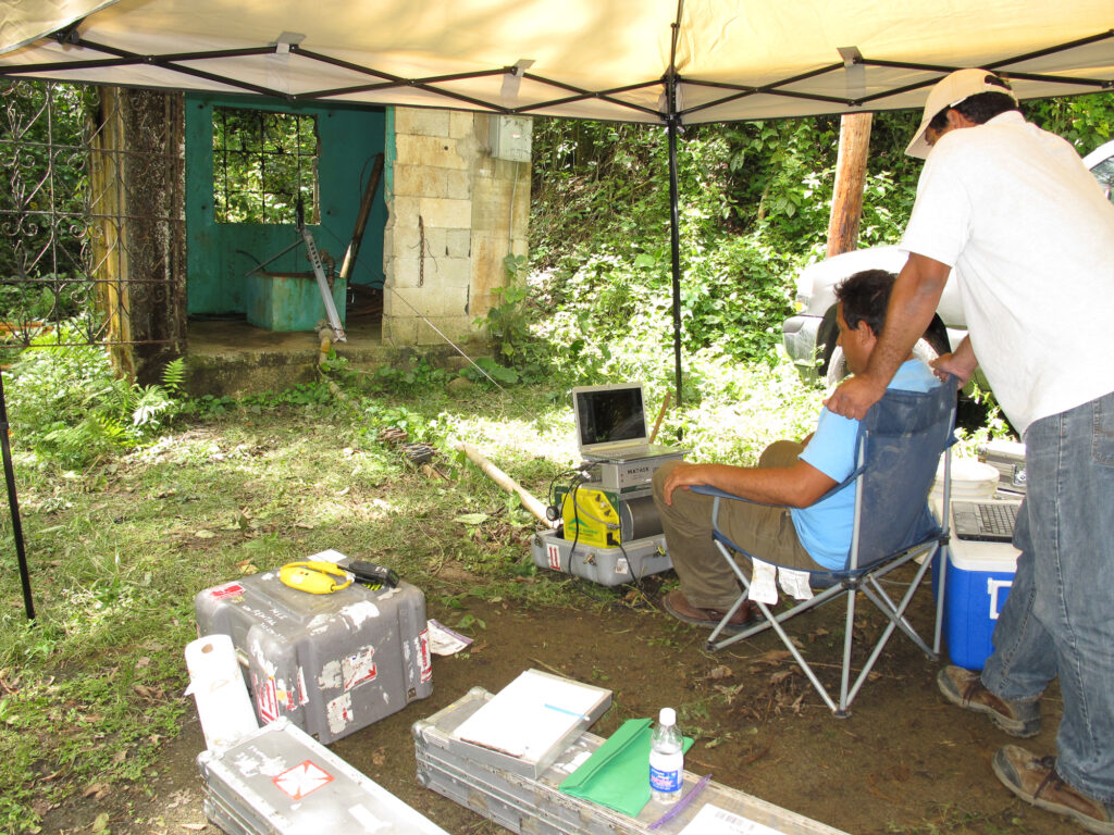
GeoView was tasked to conduct borehole geophysical logging of at a groundwater extraction well in the rural area of the Municipality of Corozal, Puerto Rico. Prior groundwater tests indicated possible contamination of the groundwater. The study area was primarily underlain by stratified, mostly dark gray basaltic tuff, andesite and basalt porphyry rocks assigned to the Los Negros Formation of Lower and Upper Cretaceous with local intrusions of quartz diorite of Tertiary Age.  The mapped rocks appear highly faulted and folded and show a general NW-SE strike and moderate (45°-60°) dips to the southwest. Shear zones, intense folding and flexural-slip faulting are typical in the deformational history of the area.  The objective of the survey was to determine the physical properties of the borehole walls, fracture occurrence and vertical flow within the wells.  All the down-hole equipment was properly calibrated and decontaminated with Alconox and laboratory grade de-ionized water prior to logging at each borehole. The suite of logging at each well was conducted in the order presented below and included the following:

  • Temperature and Fluid Resistivity (Mount Sopris)
  • Mechanical 3-arm Caliper (Mount Sopris)
  • Optical tele-viewer (Mount Sopris, OBI Optical Televiewer)
  • Acoustic tele-viewer (Mount Sopris, ABI Acoustic Televiewer)
  • Gamma-SP Resistance, Normal Resistivity (Mount Sopris, 8/16/32/64 normal resistivity, Gamma, SP, SPR 41mm, 1.61” O.D.) *
  • Heat Pulse Flow-meter

 Description of methods

The combined borehole temperature and fluid resistivity probe provides a measurement of the temperature of the borehole fluid and its resistance to conducting electric current versus depth.  The probe is normally run first to obtain the natural, undisturbed thermal gradient in the borehole and will generally show sharp or gradual changes in the gradient caused by fluid flow in fractures. It is typically used to obtain water levels and to locate water-producing or reducing zones. Fluid resistivity is directly affected by the concentration of dissolved solids in the borehole fluid. Therefore, it is also useful for obtaining water quality data and changes in salinity.

Caliper logging involves the measurement of the borehole diameter versus depth. Data is collected by means of a mechanical probe consisting of 3 arms, normally separated at 120° which are attached to a potentiometer. Changes in resistance recorded in the potentiometer are recorded as voltage changes and are proportional to the borehole diameter. Caliper is useful for determining changes in borehole diameter, lithologic analysis, and presence of fractures or washout zones and to obtain well construction details such as depth of casing.

The optical and acoustic tele-viewers are useful borehole imaging probes that provide oriented, 360°, continuous digital picture and sonar-like images of the borehole, respectively. The best applications for both probes include fracture detection and evaluation, measurement of the attitude of bedding and fractures and casing inspection. Both probes must be centered at all times and are lowered in the borehole with centralizers to avoid image distortions.

The optical tele-viewer provides true-color, high-resolution images in the borehole that are useful for well construction as well as structural and lithologic interpretation.  It can be used in water-filled or air-filled holes and can provide vertical resolution to 0.02 inches. The optical tele-viewer performs better when the borehole fluid turbidity is low. Its magnetic orientation can be affected by metal casing.  In the acoustic tele-viewer, a false-color image of the borehole walls is created by ultrasonic pulses emitted by a 360° rotating transducer. The maximum resolution obtained with the acoustic tele-viewer is 0.04 inches and it can also be used to measure borehole diameter as it records both the amplitude and travel time of the acoustic pulses. The amplitude response can be used to help determine relative rock quality and whether the fractures are open or in-filled. Unlike the optical imager, the acoustic tele-viewer can be used only in water-filled holes and is not affected by high turbidity fluid.  Its magnetic orientation can be also be affected by the effects of a metal casing.

Natural gamma, single–point resistance and normal resistivity electric logging was conducted in the wells by means of a single, combined probe.  The natural gamma log measures the natural gamma ray radiation (high-energy electromagnetic rays) generated by decay of radioactive elements in clay minerals. This log is useful to determine lithologic changes in the composition of the formations and provides a relative measure of the change in clay content of the materials with depth.  The single point resistance log provides the electrical resistance measured between two electrodes (one lowered in the borehole and the other placed in the ground surface) and provides a relative measure of the change in the electrical conductivity of the formation around the borehole (when borehole fluid is homogeneous).  The normal resistivity logs measure the resistivity in ohm-meters of the underlying natural earth materials to various depths into the formation or borehole walls.  The probe uses four electrodes with spaced at 8, 16, 32, and 64 inches.  The resistivity values from the short normal (8 and 16) measures resistivity near the borehole walls whereas the long normal electrode spacing (32 and 64) provides a more accurate measurement of the formation resistivity, farther away from the borehole walls.  In aquifer units with similar rock type, changes in formation resistivity will be largely a measure of the resistivity of the fluid filling the pore space. 

The heat pulse flow meter was used in each of the logged wells to obtain stationary, relative measurements of low vertical fluid flow in the borehole. The probe is used at selected depths based on the results and identification of potential flow (fracture) zones from the previous logs. The probe consists of a set of dual temperature sensors that measure the travel time of pulse-heated fluid and can distinguish between upward or downward flow. The probe is lowered down the borehole with a centralizer and a flow-diverter. The heat pulse flow meter can accurately measure vertical flow from 0.02 gpm to 1.0 gpm or more and it is useful for groundwater flow interpretation, obtaining hydraulic parameter and fracture identification. It is noted that the heat pulse flow logging was conducted under static conditions and flow rates and directions may differ under pumping conditions.

Results

The fluid temperature and resistivity logs from the well showed that the fluid resistivity decreased slightly and the temperature increased from the water table to a depth of approximately 18.5 ft.  From this depth to the bottom of the well, the temperature log shows a slight gradual increase while the fluid resistivity shows a gradual decrease. 

The caliper log and the optical and acoustic borehole imagery from the well indicated the water level to be at 10.3 ft and that the bottom of the steel casing was at a depth of approximately 14 ft. A large opening of the borehole wall was identified from the bottom of the casing to a depth of 23.5 ft. This zone appeared as a large, sub-horizontal cavity with a central ledge or slab of rock material. The upper portion of this zone may be the result of washout of the borehole wall during drilling. A series of fractures or discontinuities with a somewhat uniform separation and similar dip were identified at depths of 23, 34, 39.5, 45 and 68.5 ft.  These may represent bedding contacts in the bedrock. The overall structural pattern as observed from the caliper and acoustic imagery logs showed a zone of severely fractured rock (possibly shear zone) at depths of 141 to 151 ft. A large fracture opening was also detected from 151 ft to the bottom of the well at 159 ft. The optical tele-viewer data showed oxidized rock surfaces in some of the fractures and borehole walls and a change in the color of the bedrock to a lighter yellowish brown and reddish at a depth of 131 ft.  

The static flow measurements with the heat pulse flow meter showed a positive (up) flow of 0.13 gpm inside the well casing at 11.5 ft.  Negative (down) flows of 0.0 to 0.02 gpm were measured at a depth of 17 to 18 ft, within a narrower portion of the large washout area.  Measurements taken at 27, 30, 37, 50, 130 and 150 ft show a significant down flow with values of 0.55, 0.93, 0.33, 1.03, 0.67 and 0.90 gpm, respectively. These high flows were at or exceeded the maximum limits of the flow meter. Actual flows may exceed these indicated flows.

The interpretation of the logs from this well suggested that groundwater enters the well under static condition from a depth of 18 to 23.5 ft. The logs indicate that the remaining fractures in the well act as large, water-reducing or thief zones during static conditions. The large fracture identified at the bottom of the well is the most significant reducing zone. The results were also used to help guide subsequent packer tests.

Click Images Below to Enlarge


Deviation Log Showing Path of Borehole


Example of Borehole Data Showing Cavity