Bathymetric Study
Marion County, FL / Echosounder
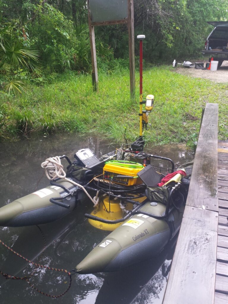
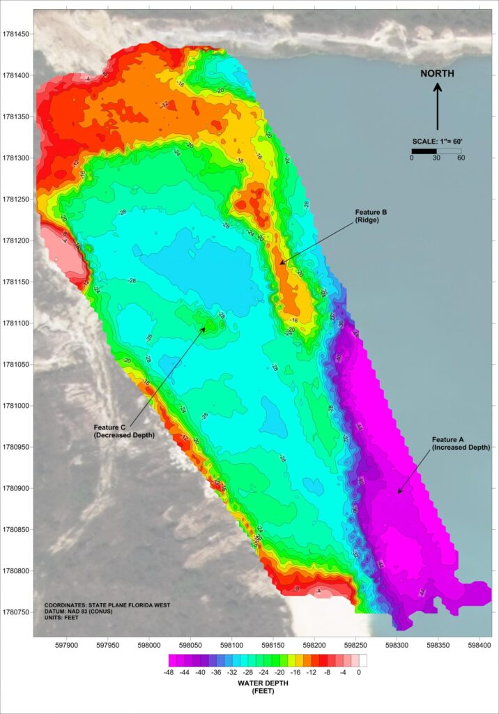
GeoView, Inc. conducted a bathymetric study within the western portion of pond at a limestone mine in Marion County, Florida. As part of a roadway expansion project, the western portion of the pond was to be infilled. The purpose of the study was to map the water depth in order calculate slope analysis and fill volume. Due to site access, a portable pontoon boat had to be used for the survey. The bathymetric survey was conducted using an echosounder with a 200 Kilohertz transducer. The high frequency and rapid pulse rate enabled accurate mapping of the pond bottom.
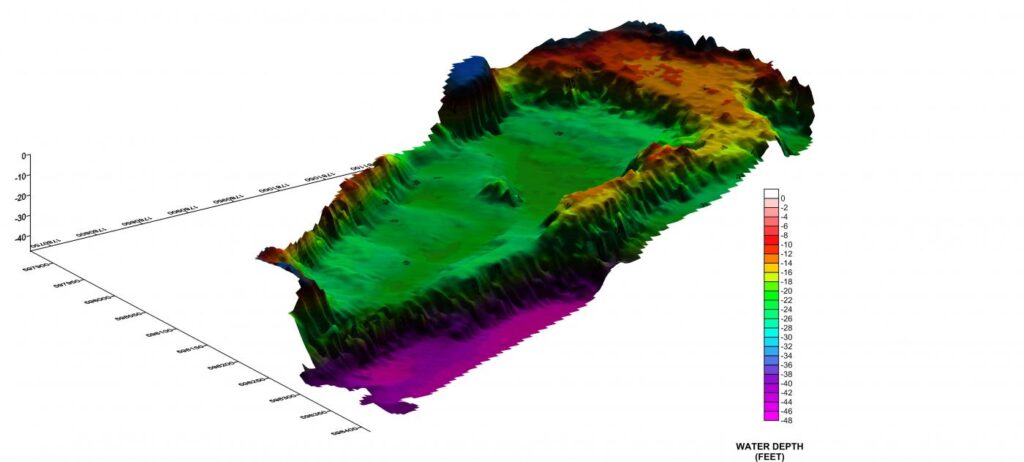
The data was processed using Hypack© software. Contour maps of the depth to the pond bottom were produced. The results showed the majority of the pond being approximately 30 ft deep, with a shallower plateau on the northern portion and a significantly deeper area in the southeastern corner. The results were used by the engineering team to calculate the amount of fill required for the roadway expansion.