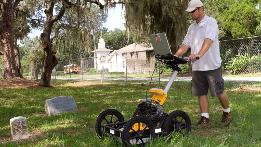
GeoView conducted a ground penetrating radar (GPR) study at an existing cemetery in central Florida. The survey was conducted in 2007. The cemetery planned to expand into new and develop within existing areas of the cemetery. However, the exact locations of the graves and boundaries of the cemeteries were not well defined.
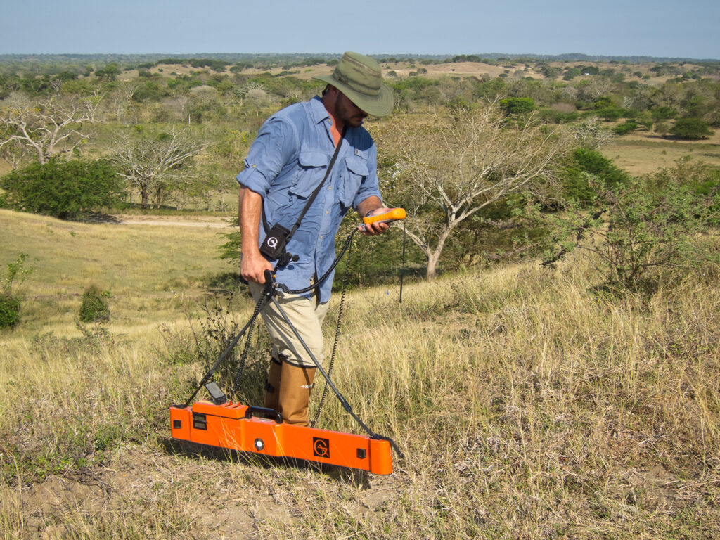
A pipeline is planned to transport oil from the Cordillera de Mérida mountain range of northeastern Colombia west towards the Pacific Ocean. An archeological investigation is being conducted by others along the proposed pipeline route to determine potential areas of historical significance. As part of the project, GeoView was asked to provide a geophysical survey within twelve areas to help identify pre-Columbian artifacts prior to the construction of the pipeline.
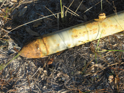
A geophysical investigation was conducted at a World War II era bombing range in the eastern United States. The site was approximately 2,000 feet by 300 feet in plan dimension. Historical information indicated that MK23 practice bombs, 2.75” rockets, and 100 pound practice bombs were used at the site.
GeoView was tasked with performing a geophysical investigation at a military base in the southeastern United States. The purpose of the investigation was to locate a reported debris burial pit. The burial pit was reported to be 60 feet (ft) in length and up to 10 ft deep. Historical records indicated that the pit contained buried drums and shop material.
Locate Abandoned Production Well
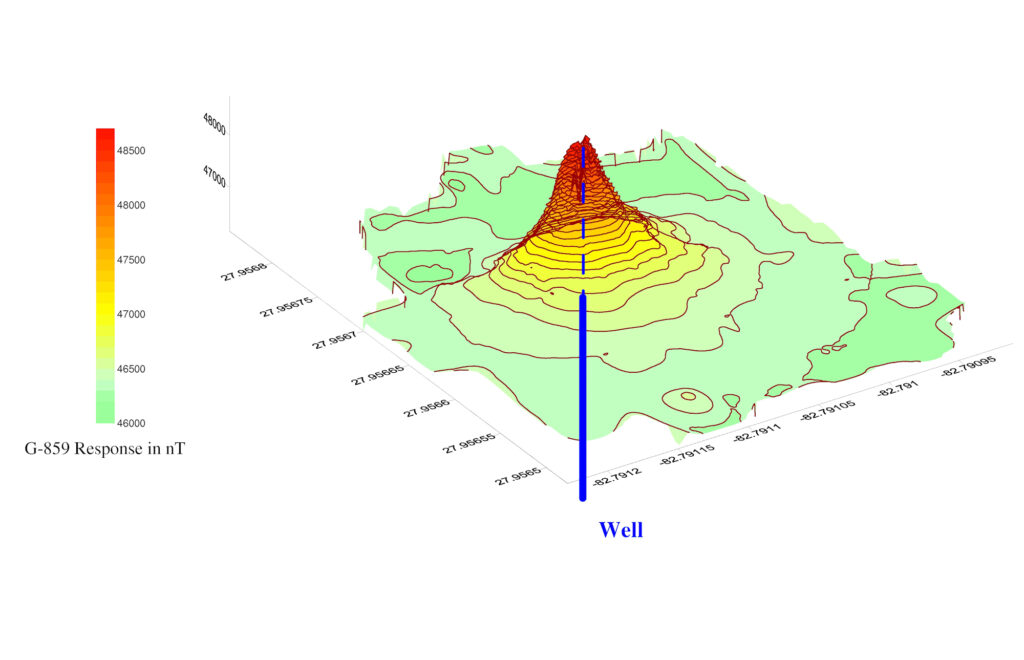
Historical records discovered during construction of a commerical building indicated that a deep well with steel casing was likely present within a portion of the project site. Regulatory officials halted construction and insisted that the presence (or absence) of the well be confirmed. If the well was present, it was required that the well be exposed so that it could be property abandoned. Because of earth work activity at the site, it was suspected that the well could be 5 to 10 ft below current grade.
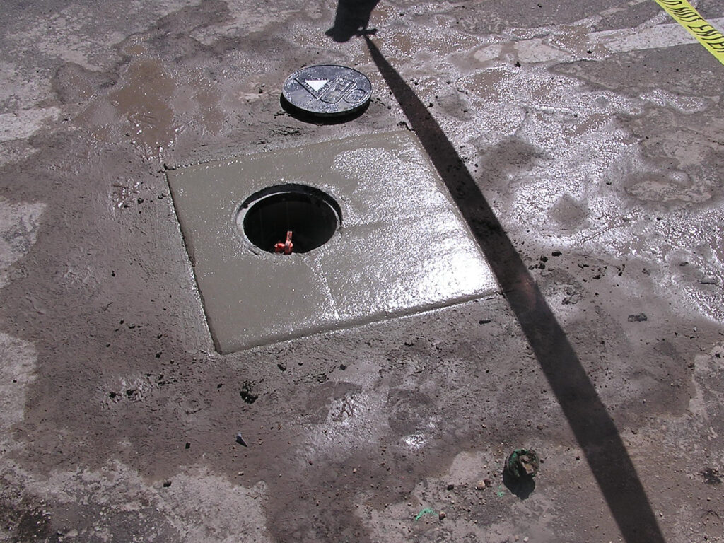
Locate Buried Monitoring Wells
Investigation was conducted at a gasoline station in Fort Myers, Florida. In order to minimize costs, our client intended to use several existing on-site monitoring wells rather than install new wells. However, five of the existing wells had been covered with asphalt and were no longer visible. GeoView was tasked with performing a shallow geophysical study to locate the five buried monitoring wells. Since the monitoring wells were constructed out of PVC with only a possible metal cap, GeoView utilized Ground Penetrating Radar (GPR) and electromagnetics (EM) to locate the wells.
GeoView was tasked with performing a geophysical investigation at a construction site in Broward County, Florida. The purpose of the investigation was to locate the boundaries of a reported former unregulated landfill. The landfill was reported to be within the location of a former limestone quarry. Historical records indicated that the landfill contained both metallic and landscaping debris. Portions of the survey area were inaccessible due to construction activity. GeoView used a combination of frequency domain electromagnetics and ground penetrating radar for the study.
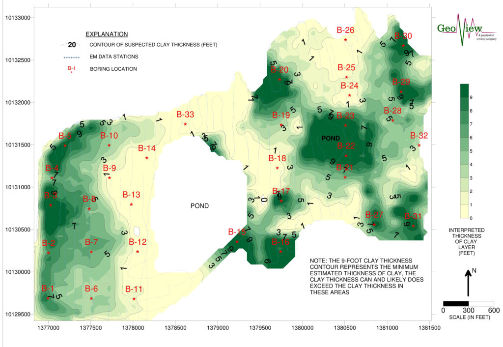
GeoView, Inc. performed a geophysical investigation across a 200 acre site in Polk County, Florida. It had been reported that clay slimes from former mining operations had been deposited on the site. The purpose of the investigation was to help determine the horizontal and vertical extent of the clay slimes. Due to the large size of the site and limited budget, the investigation was conducted using Frequency Domain Electromagnetics (EM).
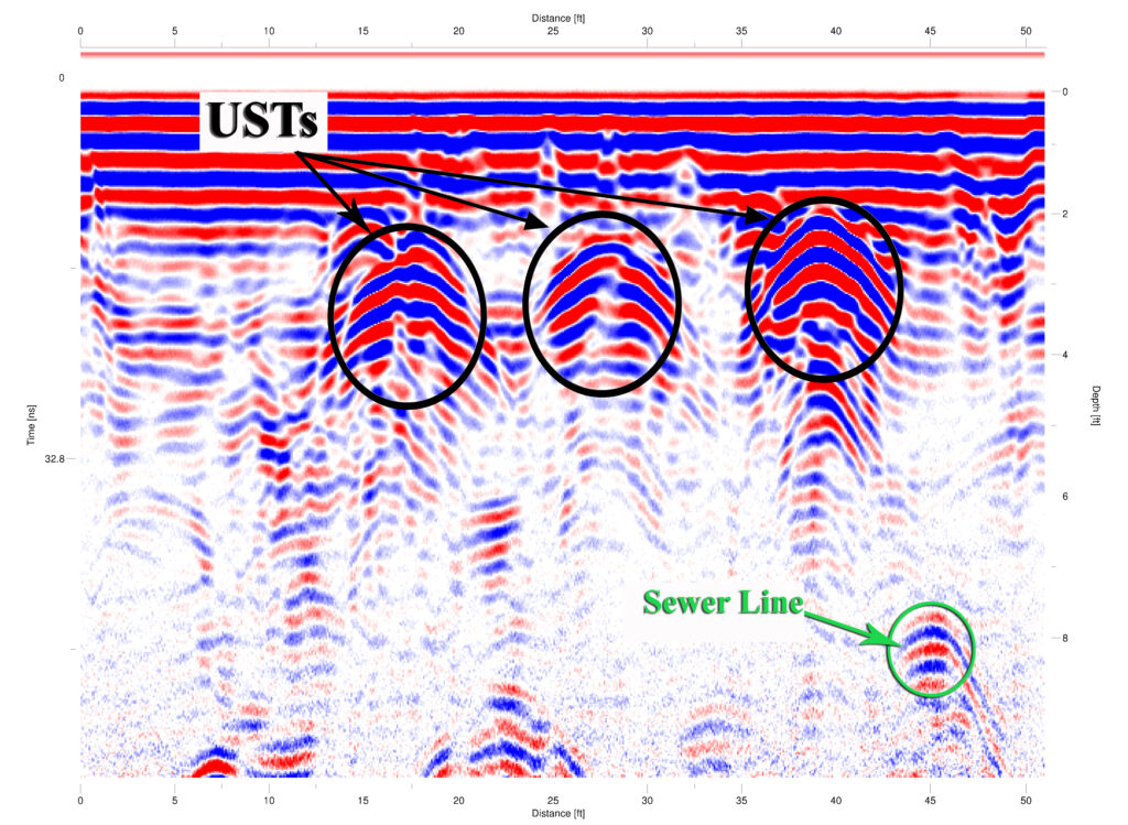
A Phase II environmental site assessment was conducted at a military base in the southeastern United States. As part of the ESA, GeoView was contracted to perform the geophysical site assessment. The purpose of the geophysical investigation was to determine the presence and location of any underground storage tanks that may be buried within the boundaries of the project site.
GeoView conducted a ground penetrating radar (GPR) investigation at C. Leon King High School in Hillsborough County, Florida. The study, performed between October 23 and November 2, 2019, was initiated following reports that a historic cemetery might be located on the school property. At the time of the survey, there were no visible burial markers or gravestones within the designated investigation areas.