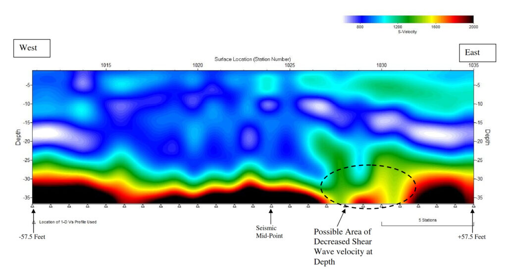
MASW is a seismic method that uses surface waves (specifically fundamental mode Rayleigh Waves) to estimate shear wave velocities. Assuming the site has vertical velocity variation (sand to clay to rock), each frequency component of the surface wave will have a different propagation velocity (phase velocity).
During the processing of the seismic data, dispersion curves can be calculated from the data of each shot point (record).
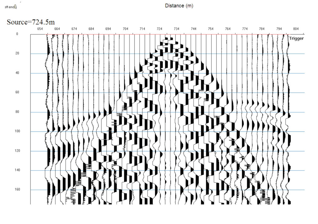
The dispersion curves show the phase velocity of the surface waves as a function of frequency. 1-D profiles of the shear wave velocity (Vs) versus depth can then be back calculated from the dispersion curve. A series of 1-D shear wave velocity profiles can be combined to produce a 2-D cross-section of the shear wave velocities along the seismic line. MASW is typically used for:
- Locating broad low velocity zones (karst [sinkhole] features, large shallow voids, fracture/fault zones, areas of cut and fill)
- Mapping stratigraphic layers
- Determining shear wave velocity for use in calculating dynamic properties of soils
- V30 measurements
- Pre-construction site characterization studies (buildings, towers, wind turbines)