Mapping Extents of Buried Wood Debris
Tampa, Florida
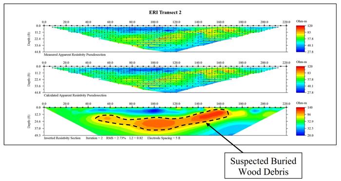
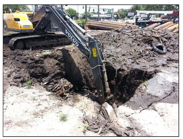
An electrical resistivity imaging (ERI) survey was conducted at a future convience store to be located in Tampa, Florida. The study site was centered about the area where buried debris had been identified to a minimum depth of 15 ft bls during excavation activities. The buried debris was composed primarily of wooden boards. The purpose of the ERI survey was to help determine the lateral and vertical extent of buried debris at the project site. At the time of the survey, the site was under active construction, with heavy equipment and trenches located throught the site. The survey had to be conducted during off hours to avoid impacting the construction schedule.
 An area with a localized increase in the resistivity of the subsurface earth materials was observed on each of the ERI transects. The area of elevated resistivity is within the area where buried wooden boards were excavated from the site. Accordingly, it is suspected that the boundaries of this elevated resistivity area correspond to the boundaries of the wooded debris. The estimated maximum depths of the suspected wooded buried debris, based on the ERI results, ranges from approximately 15 to 35 ft.