Locate Buried Monitoring Wells
Fort Myers, Florida / 2013 / EM, GPR
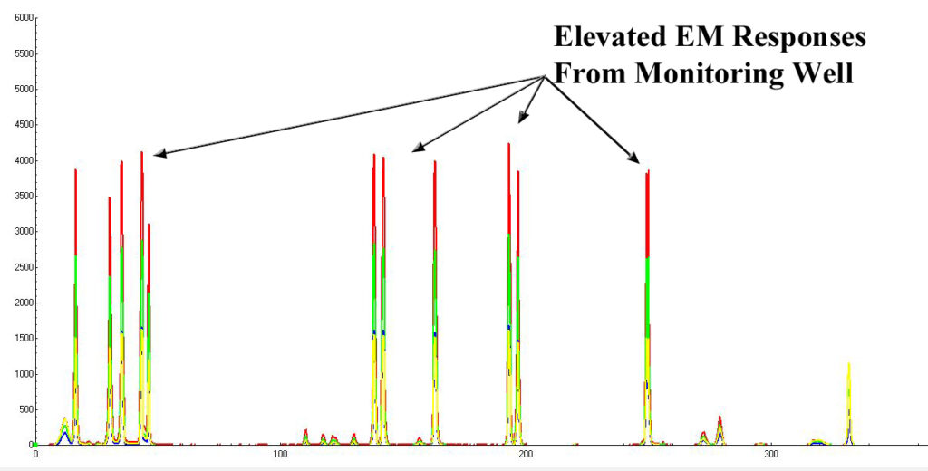
Investigation was conducted at a gasoline station in Fort Myers, Florida. In order to minimize costs, our client intended to use several existing on-site monitoring wells rather than install new wells. However, five of the existing wells had been covered with asphalt and were no longer visible. GeoView was tasked with performing a shallow geophysical study to locate the five buried monitoring wells. Since the monitoring wells were constructed out of PVC with only a possible metal cap, GeoView utilized Ground Penetrating Radar (GPR) and electromagnetics (EM) to locate the wells. The EM would respond to shallow metallic parts of the well including cover plates, locks and hinges.
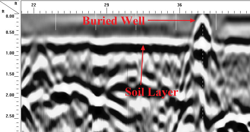
The GPR would help define the geometry and depth of the target.
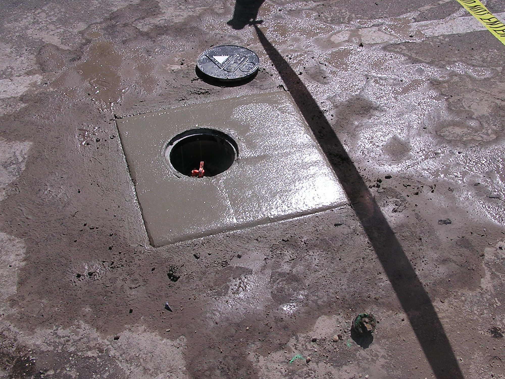
The GPR study was conducted with a GSSI SIR 3000 with a 900 MHz antenna. The EM survey was conducted with a Geonics EM-61. The data was analyzed ‘real-time’ and the anomalies were marked in the field with spray paint. Once all five suspected wells were found, the asphalt was cut to confirm and expose the tops of the monitoring wells. All five wells were successfully found and were able to be utilized for the Phase II ESA. New well caps and concrete were installed around each well at the conclusion of the survey.