Buried Debris Study
Saufley Field, Escambia County, Florida / 2011 / TDEM, EM, GPR
GeoView was tasked with performing a geophysical investigation at a military base in the southeastern United States. The purpose of the investigation was to locate a reported debris burial pit. The burial pit was reported to be 60 feet (ft) in length and up to 10 ft deep. Historical records indicated that the pit contained buried drums and shop material. The area of investigation was approximately 10 acres in size. GeoView used a combination of frequency and time domain electromagnetics, magnetics and ground penetrating radar for the study.
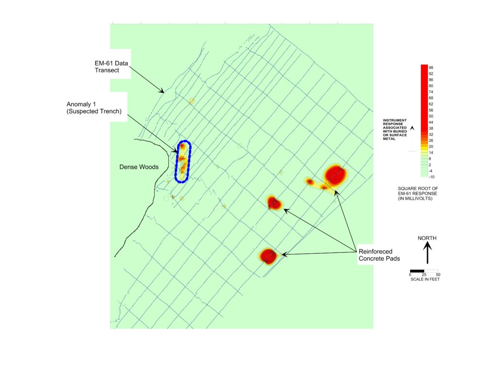
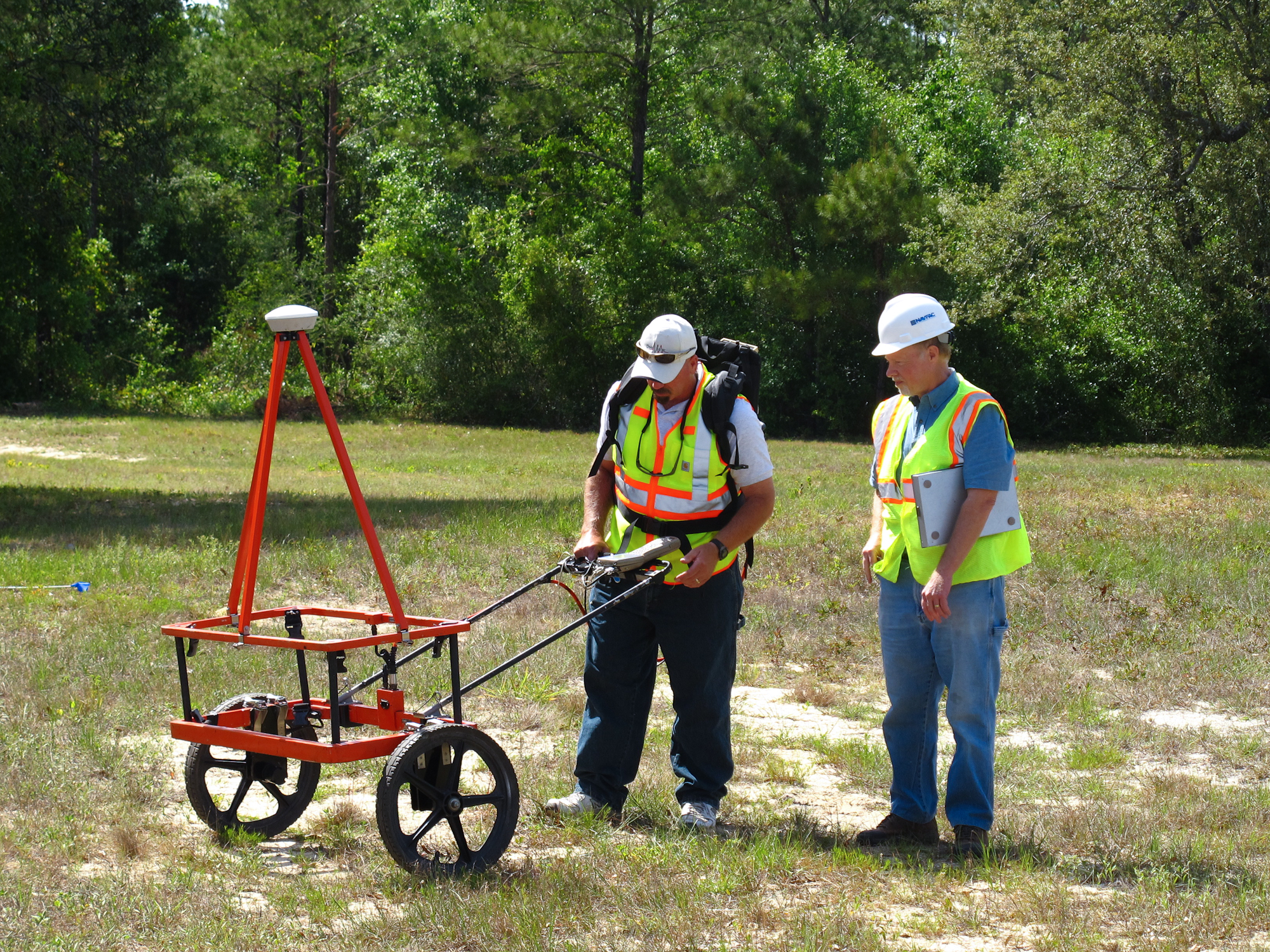
The time domain electromagnetic (TDEM) portion of the geophysical investigation was conducted using a Geonics EM61-MK2 Buried Metal Detector. The EM-61 is capable of detecting a single metal drum to a depth of 9 ft below land surface (bls). The frequency domain electromagnetic (EM) portion of the geophysical investigation was conducted using a Geonics EM31-MK2 in a vertical dipole orientation. This orientation provided bulk conductivity readings for soils to an approximate depth of 15 to 17 ft bls. The both the TDEM and EM methods respond to the presence of metals that are both iron-bearing (ferrous) and non-ferrous (e.g., aluminum or brass).
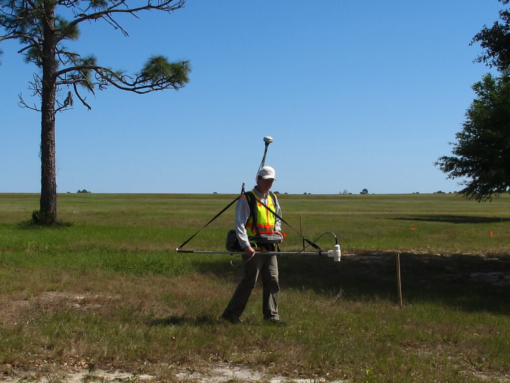
The magnetics survey was conducted using a Geometrics 859 Cesium Vapor magnetometer. The magnetometer method only responds to the presence of ferrous metals. The magnetometer method is extremely sensitive and will typically respond to smaller accumulations of metallic debris than the EM method.
The magnetometer method also has the ability to detect materials that occur at depths greater than either the EM or TDEM methods. However, the magnetometer method can be more susceptible to sources of interference.
The GPR data was collected using a Mala radar system with a 250 and 500-megahertz antenna. The GPR provided information to an estimated depth of 10 to 18 ft below land surface (bls).
The geophysical survey successfully identified one large suspected debris pit and multiple smaller, additional areas of buried trash and debris within the survey area. The suspected debris pit was approximately 85 ft by 15 ft in size. Based on the GPR data, the debris/objects within this suspected trench ranged from 2 to 12 ft bls. Based upon the elevated EM and magnetic responses within this area, it was suspected that the majority of the debris within the burial area was metallic. Subsequent intrusive testing confirmed the presence of buried drums and other metallic debris.