Historical Graves
Orlando, FL / 2007 / GPR
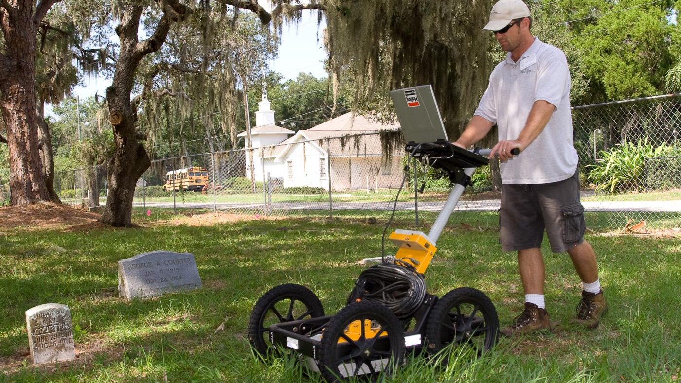
GeoView conducted a ground penetrating radar (GPR) study at an existing cemetery in central Florida. The survey was conducted in 2007. The cemetery planned to expand into new and develop within existing areas of the cemetery. However, the exact locations of the graves and boundaries of the cemeteries were not well defined. The GPR was used to locate anomalous features potentially associated with gravesites. The GPR survey was collected using a mid-frequency antenna on parallel transect lines spaced 2 feet apart across the 6-acre site. The raw radar grams were processed and compiled to form 3D depths slices of the subsurface.
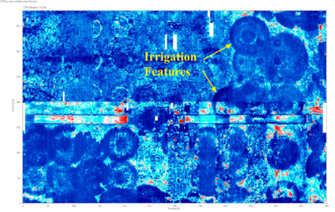
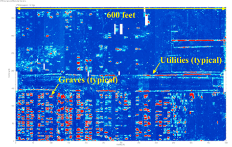
The GPR method was effective in identifying numerous suspected graves within the survey area. The data clearly showed both vacant areas within the existing cemetery and the boundaries of the cemetery. In addition, the GPR showed several suspected utilities and even resolved large circular features believed to be associated with changes in moisture content from circular irrigation sprinklers. Examples of the 3D GPR data collected at the project site are provided below.