Here you can find all of our latest updates and information on the geophysical technology that we use. We will be discussing everything from the basics of Ground Penetrating Radar to the most recent, cutting edge geophysical technology. We even bring you expert knowledge and lessons from renowned industry professionals. Enjoy!
Elevating Subsurface and Infrastructure Surveys: Drone Thermal Imaging with the DJI Matrice 300 RTK and Zenmuse XT2
At GeoView, providing precise site investigations means looking at target areas from every possible dimension—and sometimes the best perspective comes from above. By pairing our ground-based geophysical tools with advanced aerial technology, we capture comprehensive site data faster and more safely than ever before. Central to our aerial ops is our DJI Matrice 300 RTK (M300) integrated with the Zenmuse XT2 dual-sensor thermal payload.
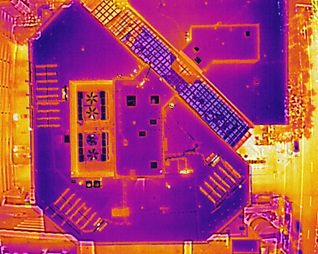
The M300 RTK serves as a high-performance flight platform offering Real-Time Kinematic positioning, providing centimeter-level spatial accuracy across complex terrain. When equipped with the Zenmuse XT2—which integrates FLIR radiometric thermal technology alongside a 4K visual camera—our operators capture synced thermal and visual data simultaneously. This dual-vision capability allows us to highlight subtle surface thermal anomalies (such as heat loss in structures, moisture entrapment, or ground temperature shifts over hidden infrastructure) while cross-referencing them against high-resolution visual evidence in real time. Combining aerial thermal insights with GPR, ERT, or seismic data gives our engineering clients an uncompromised, data-driven picture from the air down to the deep subsurface.
Also check out our recent case studies where we have been able to utilize this amazing technology
Ground Penetrating Radar Explained: How GPR Works Step-by-Step
Whether you are a seasoned geophysics professional or simply curious about the hidden world beneath your feet, join Dr. Jan Francke for an engaging and accessible journey into the heart of Ground Penetrating Radar. In this episode of GPR Decoded, Dr. Francke strips away the complex jargon to reveal how this remarkable technology acts as a “symphony of echoes,” turning invisible radio ripples into clear pictures of the subsurface. With a friendly approach tailored for anyone with a basic curiosity about physics, the video invites you to discover how simple moisture changes and electromagnetic pulses can unveil everything from ancient artifacts to modern infrastructure. It is a perfect starting point for anyone looking to understand the “magic” behind the machinery and gain a deeper appreciation for the science of seeing the unseen.
TikTok on Tech Talk!
Check out GeoView’s new TikTok page where we will be featuring more of the geophysical tech that we use in the field