Residential Sinkhole Investigation
Hernando County, FL / 2006 / ERI and MASW
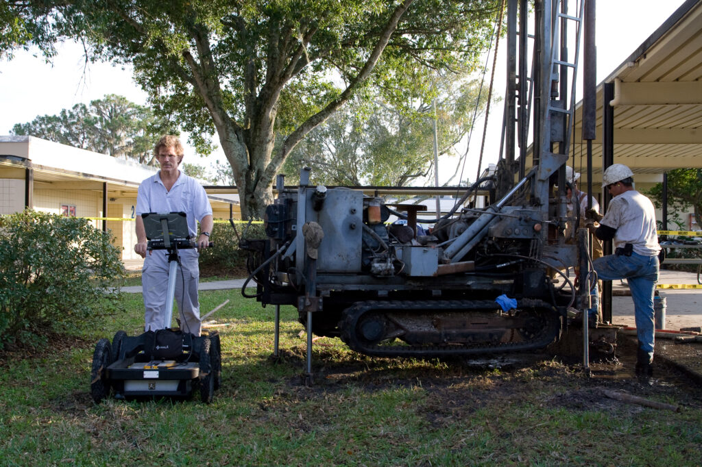
Geophysical techniques are commonly used as part of geotechnical investigations for sinkhole claims of residential structures. GeoView, Inc. has performed thousands geophysical surveys for residential sinkhole investigations throughout Florida, Tennessee and Georgia. The investigations involve performing ground penetrating radar (GPR) and/or electrical resistivity imaging (ERI) or MASW to help identify karst features. In addition, a floor elevation study is often conducted to detect changes in the slope of the floor of the residence. The GPR data is collected with a Mala radar system with either 100, 250 or 500 Megahertz antennas. The data is collected on a 10 foot by 10 foot grid across the property in the area of the residential structure and, if requested, within the interior of the residence. In areas of poor GPR signal penetration due to shallow clays or if required by the insurance company, the study is enhanced with an ERI or MASW study. The ERI data is collected with an Advanced GeoSciences R8 Sting/Swift System. The MASW data is collected with 4.5 Hz geophones and a Geometrics Geode Seismograph. The ERI data is typically collected along four transect lines oriented parallel to the exterior walls of the residence.
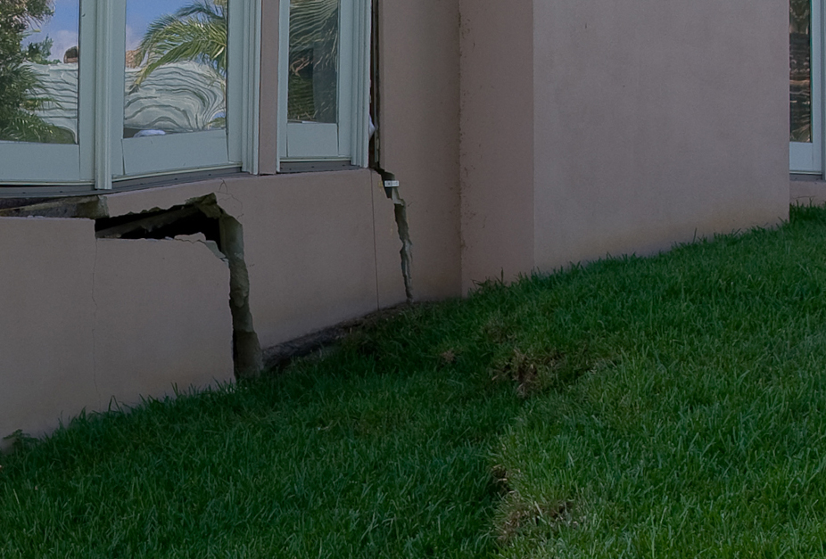
The following examples show the results of a geophysical study conducted as part of a geotechnical sinkhole investigation in Hernando County, Florida. The geophysical study was conducted with both GPR and ERI. The GPR data was able to help identify the top of three suspected sinkhole features, while the ERI was able to image the sinkhole formations within the underlying limestone. A floor elevation study conducted within the house also indicated a general slope of the floor down towards the most significant geophysical anomaly. Subsequent standard penetration test borings of the anomalies confirmed the presence of sinkhole conditions within these areas.