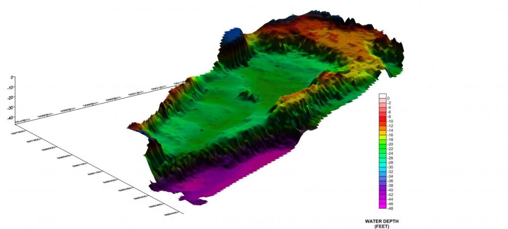
GeoView, Inc. conducted a bathymetric study within the western portion of pond at a limestone mine in Marion County, Florida. As part of a roadway expansion project, the western portion of the pond was to be infilled. The purpose of the study was to map the water depth in order calculate slope analysis and fill volume. Due to site access, a portable pontoon boat had to be used for the survey.
Sediment Thickness of a Coal Ash Pond
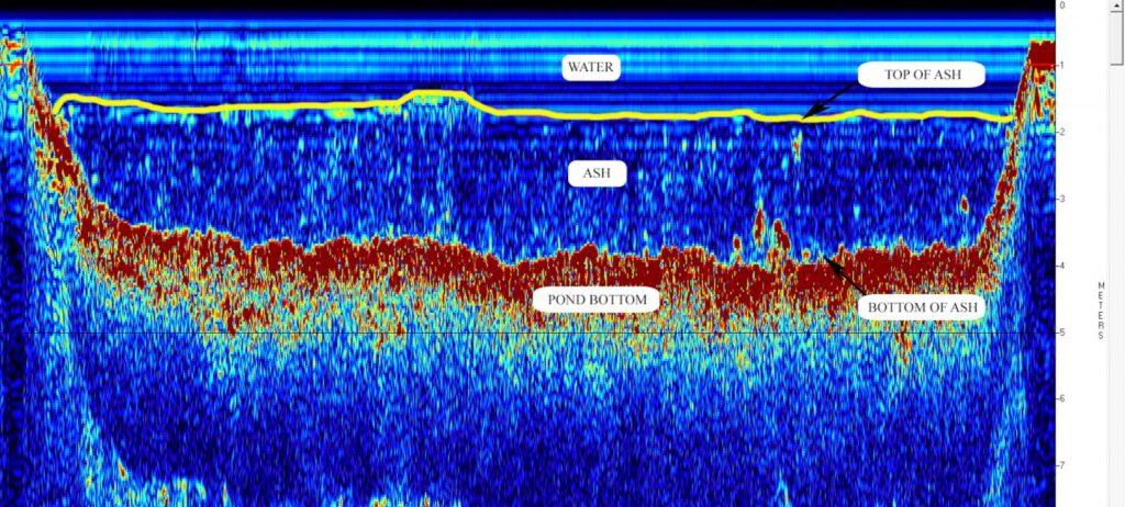
Recent updates to how the EPA regulates coal ash have made it necessary for power plants to study the designs of their existing ash ponds and determine the thickness of the ash sediments within the ponds. GeoView’s portable sub-bottom profiling system has proven to be extremely effective for this purpose.
Mapping Top of Rock and Sediment Thickness
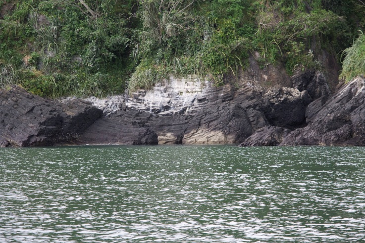
A port expansion was planned off the coast of San Felipe, Panama. GeoView was tasked to provide bathymetric information within the survey area, map the top of rock and evaluate the thickness of the overlying marine sediments. The survey area was approximately 300 hectares in size. GeoView collected sub-bottom profiling and bathymetry data along transect lines spaced approximately 25 meters on center.
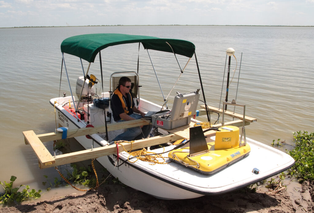
Bathymetric and sub-bottom surveys were conducted within a clay settling pond at a Phosphate mine in Central Florida. Prior to the geophysical survey, a depression or slump had formed along the northern dam of the pond. The purpose of the study was to map various sediment layers within the pond to help determine if the depressions or slumps were related to sinkhole activity or if they were related to dredging activity.