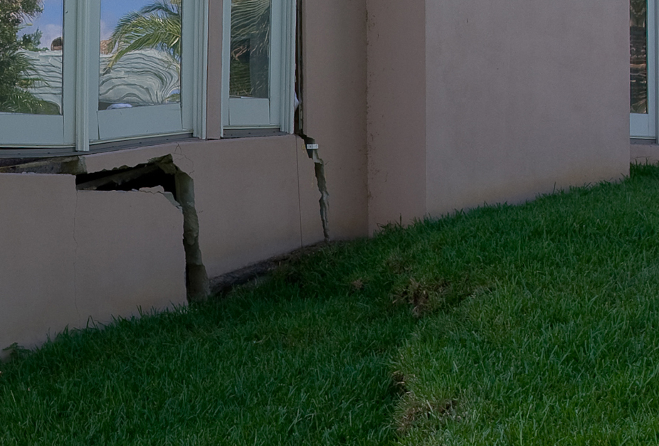
Residential Sinkhole Investigation
Geophysical techniques are commonly used as part of geotechnical investigations for sinkhole claims of residential structures. The data is collected on a 10 foot by 10 foot grid across the property in the area of the residential structure and, if requested, within the interior of the residence. In areas of poor GPR signal penetration due to shallow clays or if required by the insurance company, the study is enhanced with an ERI or MASW study.
Geological Characterization Study
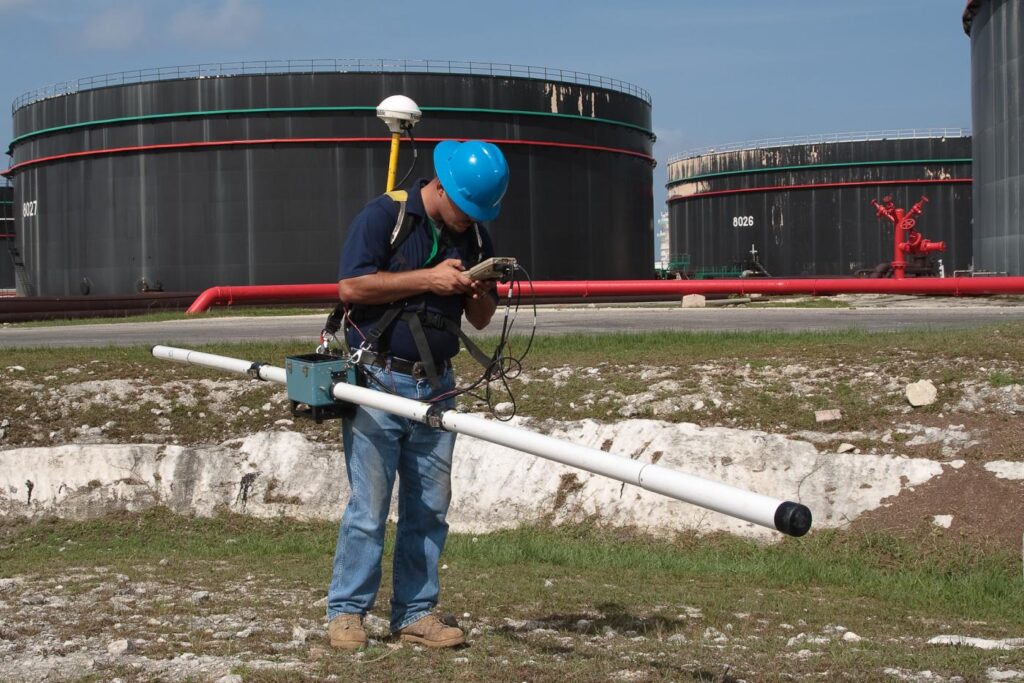
GeoView, Inc. performed a geophysical investigation across a 65-acre area where large bulk oil storage tanks were planned for construction. The purpose of the investigation was to evaluate the condition of the underlying limestone, which from previous work was known to be suspect in certain areas.
Mapping of Freshwater Aquifers
GeoView was tasked to map the lateral and vertical extent of the freshwater lenses (aquifers) on the island using EM and ERI and compare the results to previous work. A methodology was developed so that future researchers using EM tools could easily document changes to the shalllow freshwater aquifer.
Seismic Refraction and ERI Study
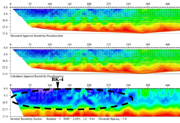
An environmental assessment and remediation design project was conducted at a chemical manufacturing facility in eastern Tennessee. As part of the project, GeoView was asked to determine the depth to limestone bedrock underlying the project site and identify any suspected karst features within the upper portion of the limestone stratum.
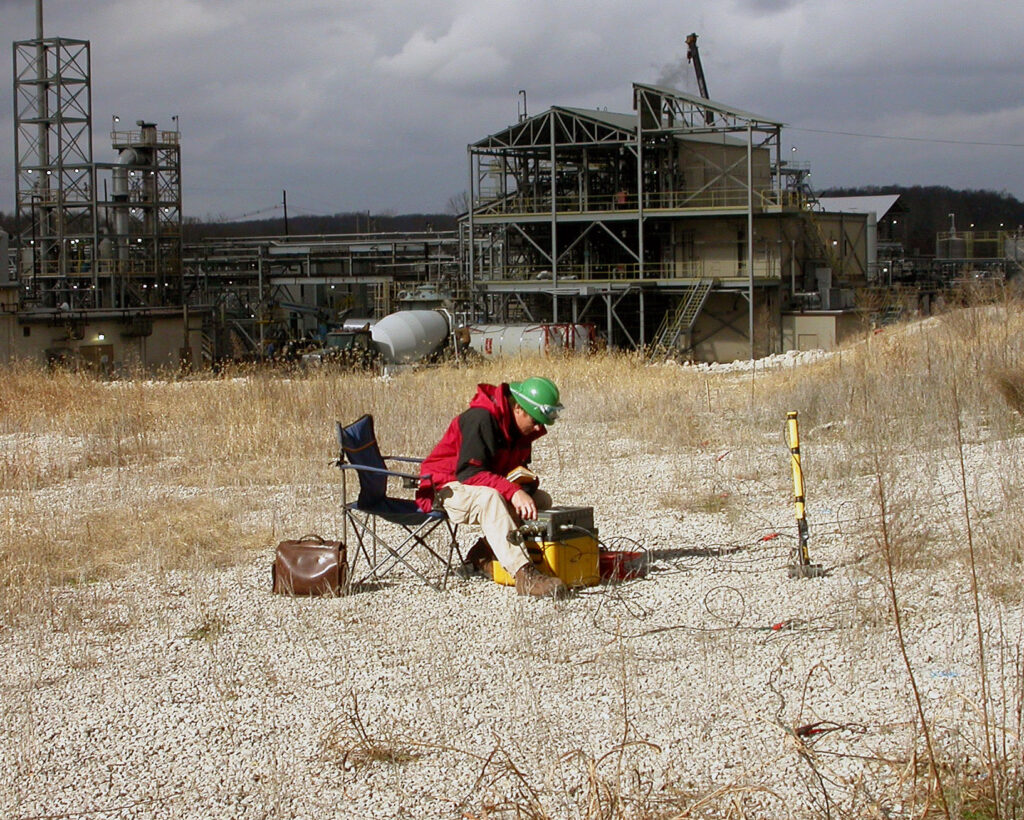
A geophysical site characterization study was performed by GeoView to assist in the placement of a planned Class 2 Landfill in Florida. The survey area was approximately 160 acres. GeoView performed a ground penetrating radar (GPR) study map the lateral boundaries and determine apparent severity of karst (sinkhole) features. Electrical resistivity imaging (ERI) was later used to provide a vertical characterization of the GPR-identified features.
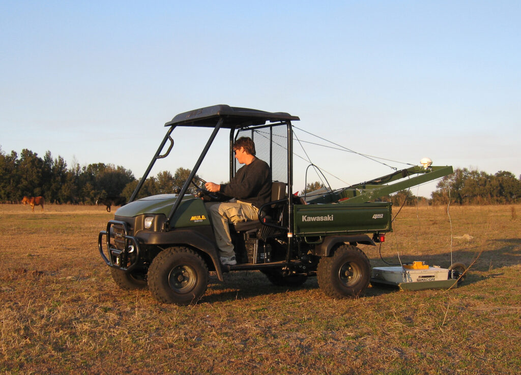
MASW and Resisitivity Sounding
Our client was coordinating the conversion of an oil-burning power plant to natural gas. As part of the associated geotechnical study, GeoView, Inc. was tasked with determining the S-wave velocity and vertical resistivity structure at the site. For the seismic portion of the study, MASW (Multi-channel Analysis of Surface Waves) and ReMi (Refraction Microtremor) methods were utilized. Challenges for the project included multiple sources of subsurface and above-ground interference and the fact that the study needed to be conducted while the plant was in operation.
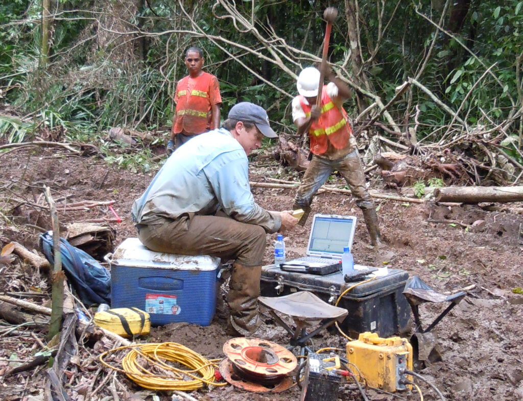
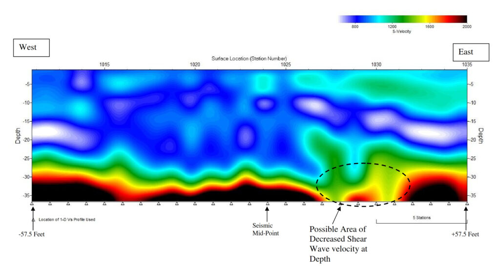
Seismic Refraction and MASW Study
The Autoridad del Canal de Panama (ACP) conducted a geotechnical investigation along the footprint of a proposed bridge crossing of the Panama Canal, north of the Gatun Lock. As part of the geotechnical study, GeoView, Spotlight Geophysics and ATI Panamericana were tasked to provide seismic P-wave and S-wave velocity structure of the subsurface. The consortium collected seismic refraction and multi-channel analysis of surface waves (MASW) data along survey transects approximately 4 kilometers in length. The terrain was extremely rugged and access was difficult along portions of the site.