Underground Storage Tanks
Objective
A Phase II environmental site assessment was conducted at a military base in the southeastern United States. As part of a Phase II environmental site assessment, GeoView was contracted to perform the geophysical site assessment. The purpose of the geophysical investigation was to determine the presence and location of any underground storage tanks that may be buried within the boundaries of the project site.
Method
The geophysical investigation was conducted using time domain electromagnetics (TDEM), ground penetrating radar (GPR), and an electronic utility locator. Geophysical measurements were conducted along transects spaced 2.5 to 5 feet apart.
Results
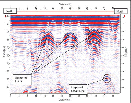
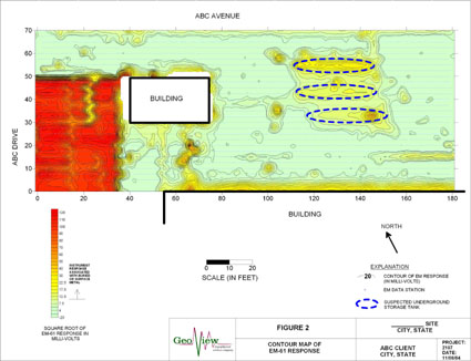
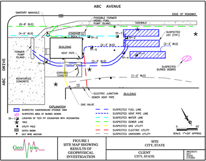
Three previously unknown underground storage tanks were discovered during the investigation. The tanks are evident on both the GPR transects (Figure 1) and the EM-61 contour map (Figure 2). The three tanks were each approximately 30 feet in length. The former fuel pump island, associated fuel lines, and other utilities of interest were also identified during the geophysical survey. The locations of the underground storage tanks and utilities were confirmed with a series of test pits. A site map (Figure 3) prepared in AutoCAD shows the results of the survey.
Figure 1 - GPR transect showing 3 underground storage tanks
Figure 2 - EM-61 contour map
|