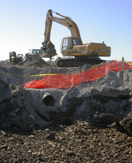
Figure 1 - Excavation of the Buried Debris Identified by the Geophysical
Survey.
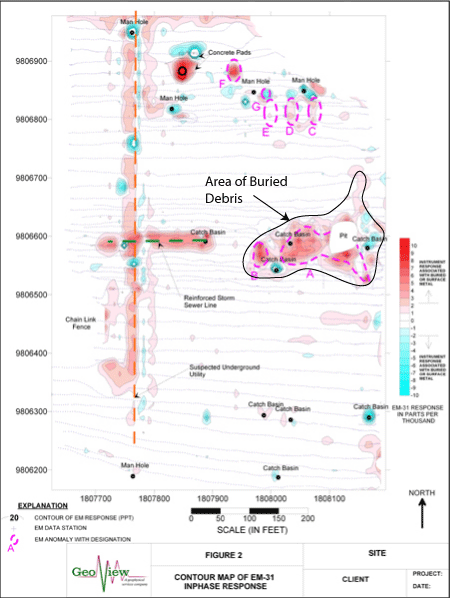
Method
The geophysical investigation was conducted using frequency domain
electromagnetics (EM-31) with an integrated Global Positioning System and
Ground Penetrating Radar (GPR). Geophysical measurements were conducted along
transects spaced 15 to 20 feet apart. A computer contouring program was used
to contour both the inphase and terrain conductivity response of the EM-31.
Results
The contour map of the inphase response identified two broad, large anomaly
areas and five small, bulls-eye anomalies. Subsequent excavation of these
anomalies revealed that the two large anomalies were areas of buried debris.
The debris included metallic drums, car parts, and miscellaneous C&D material.
Four of the five smaller anomalies were the result of buried septic tanks. One
One area within the central portion of the site showed a broad, gradual
increase in the terrain conductivity response. Prior to the geophysical
investigation, household garbage was discovered within this area of the site.
The garbage was removed and the excavated area was backfilled with fill
material. It is suspected that this area of increased terrain conductivity
response is a result of a change/increase in fill material used within this
portion of the site.